
My Via Alpina Green Experience
Via Alpina Green is a through-hiking trail that traverses Switzerland. It is a part of the longer Via Alpina Trail which traverses the Alps from Monaco to Slovenia. It is also labeled as the Swiss National Route 1. Hikers start in Vaduz (Liechtenstein) and finish in Montreux, crossing 14 mountain passes (saddle points of mountain ridges). The trail is divided into 20 sections, each connecting one town to another. All these towns are accessible by public transit during the summer and have hotels and restaurants. Furthermore, hikers have the option to take funicular trains / busses / cable cars to skip through some parts of the hike, reducing the elevation gain / loss to accommodate one’s fitness level. I took these at times to skip some steep parts, speed up the hike to make sure I finish in time, and avoid getting rained on. This article is written with the intention to provide my own perspective and to complement other existing online resources like the official Via Alpina Green website by Swiss tourism or Fabienne and Benoit’s blog.
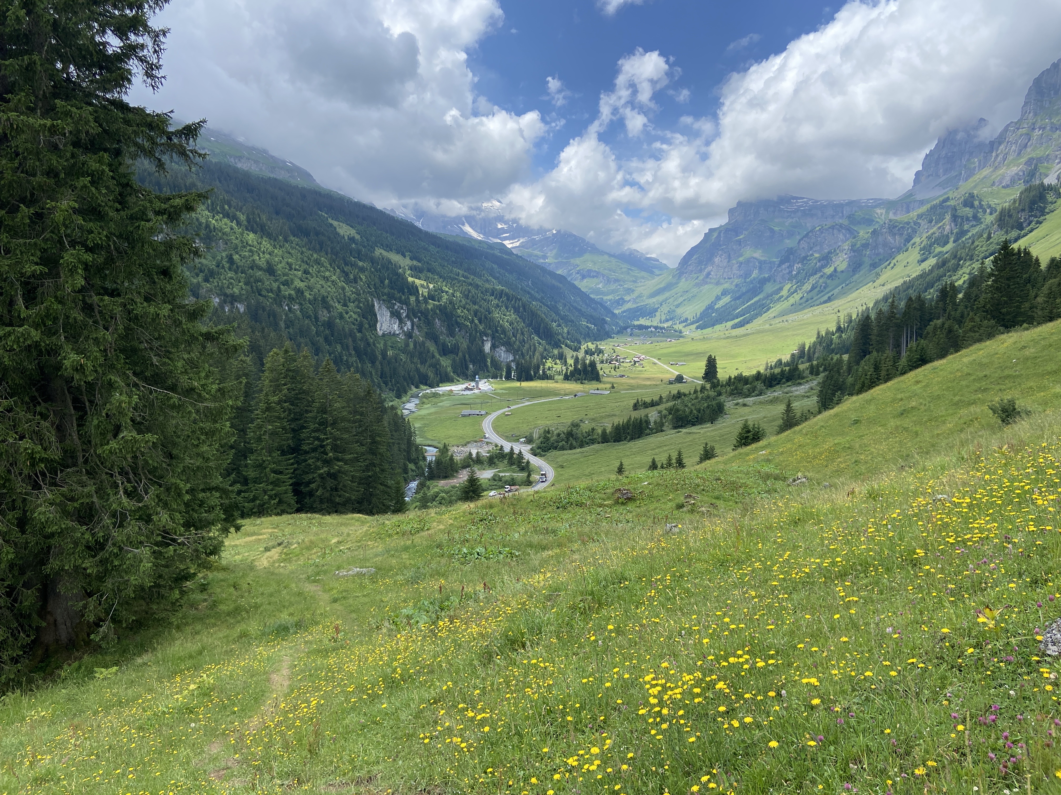
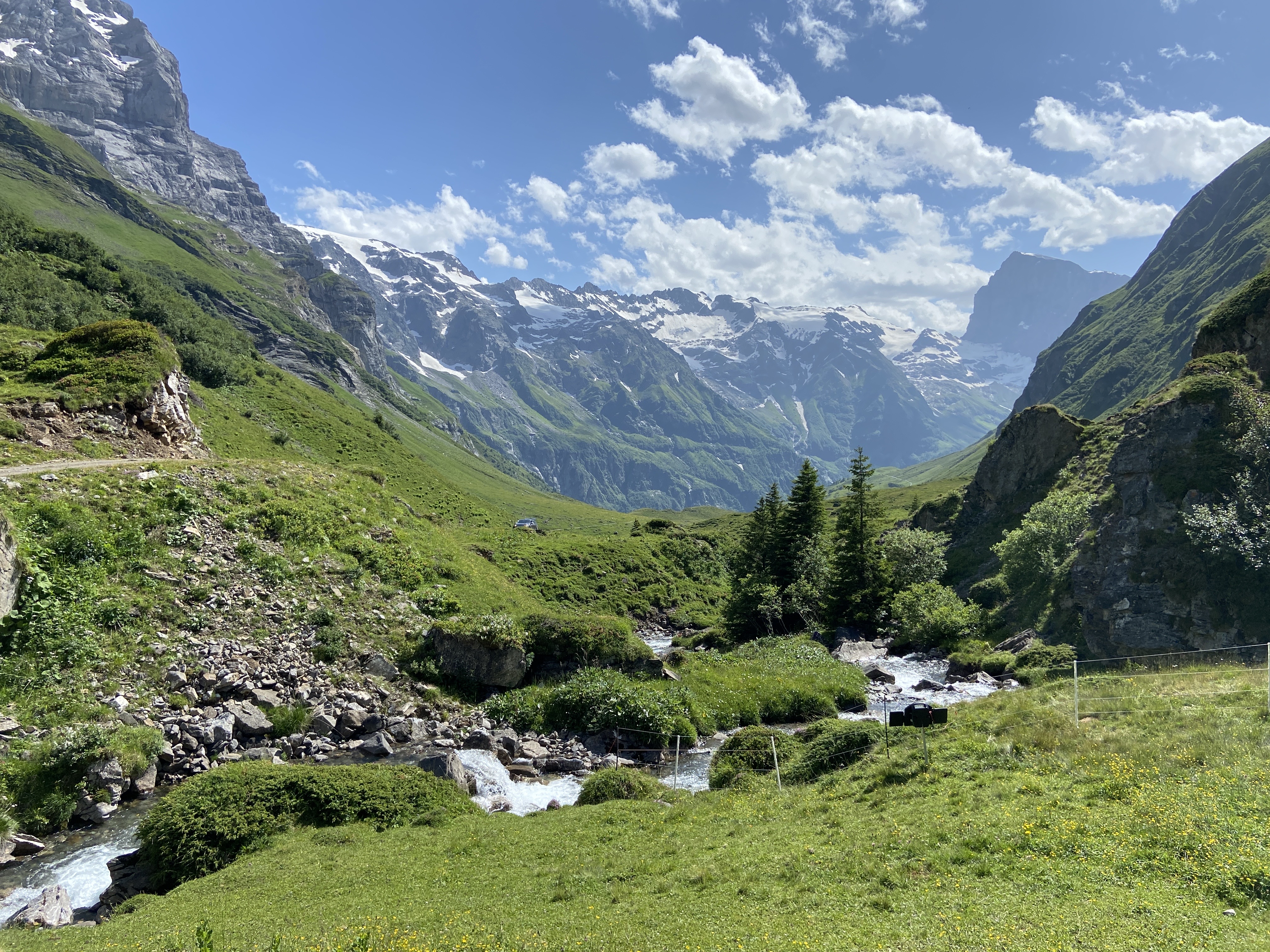
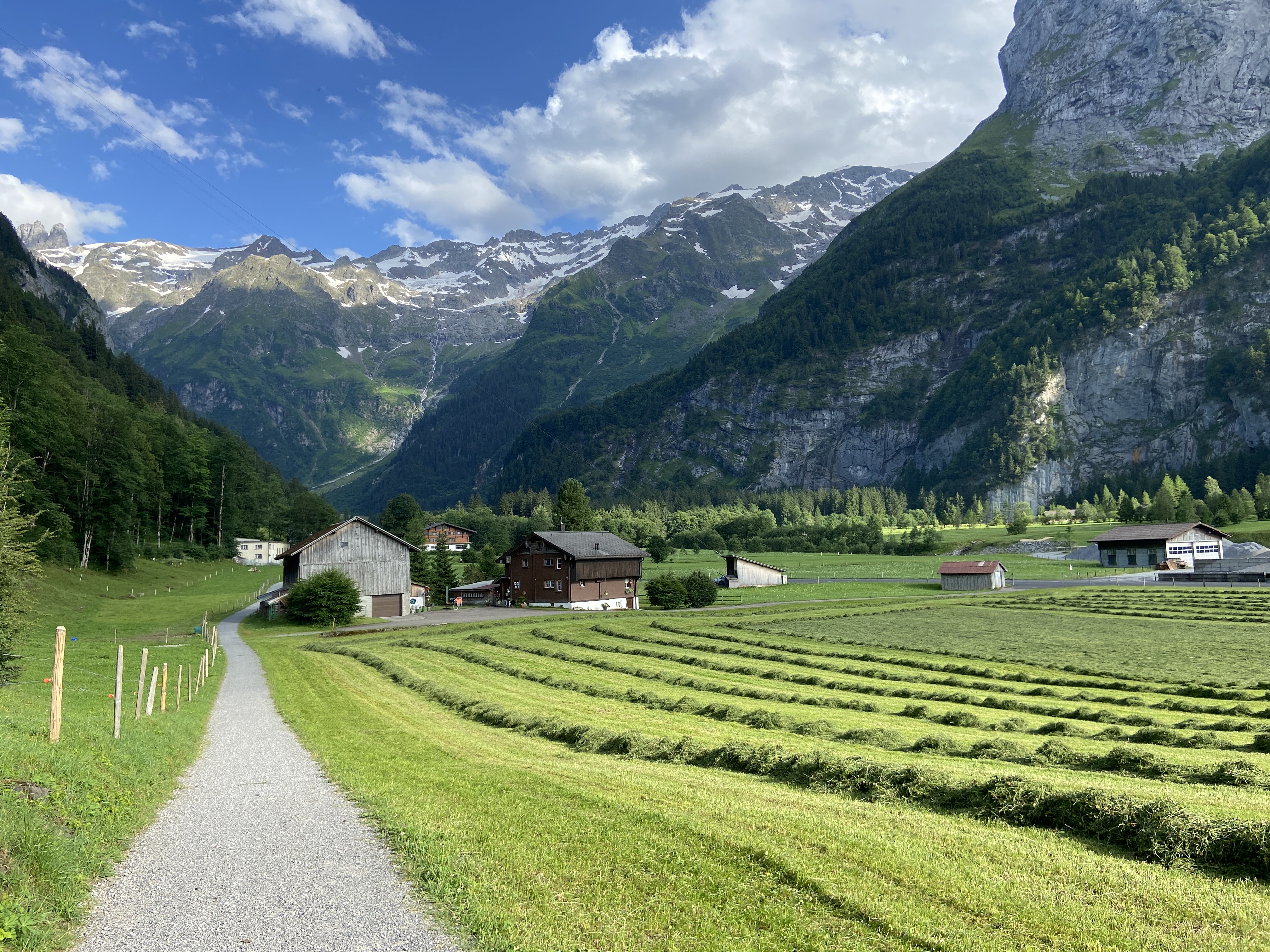
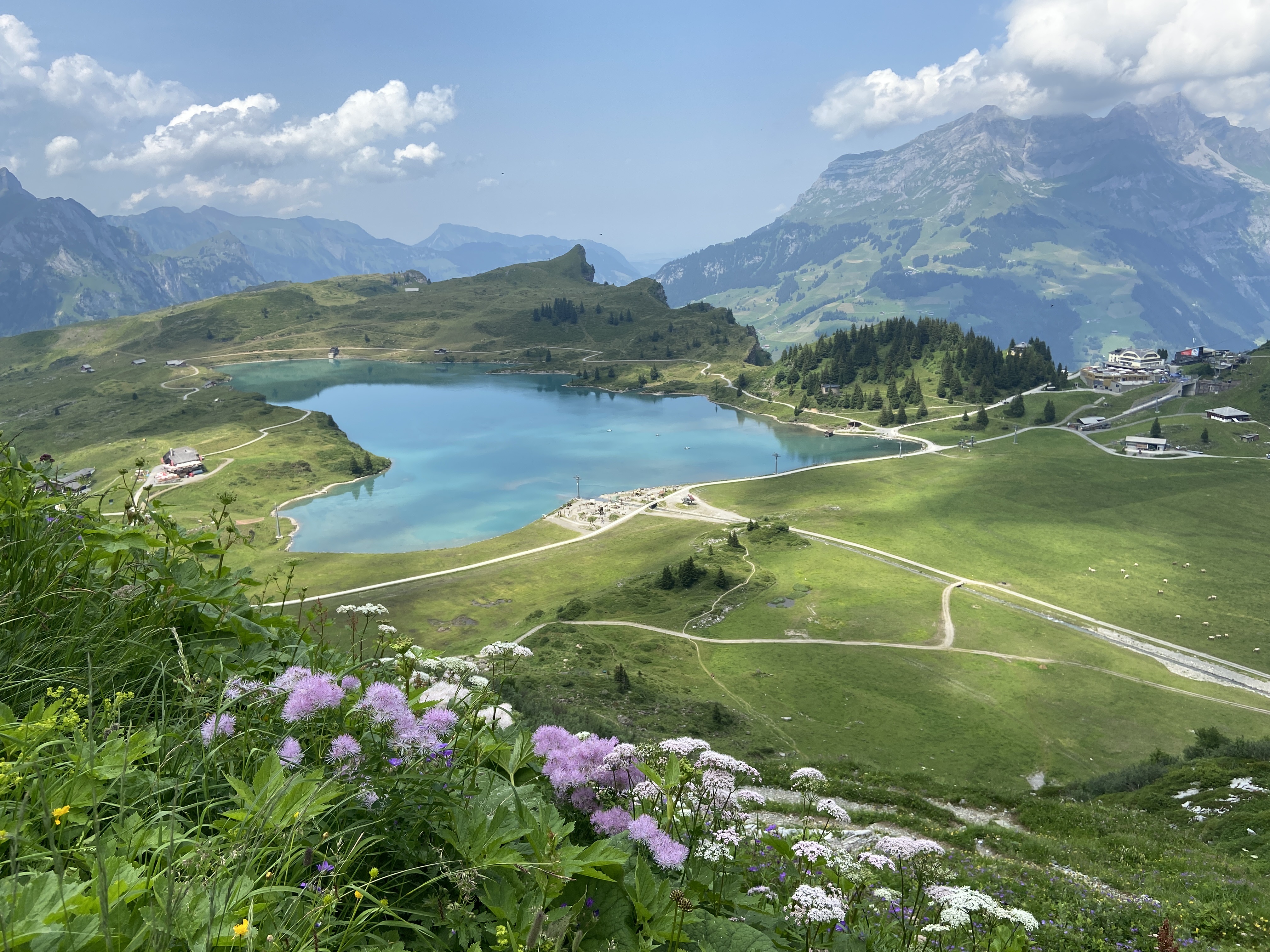
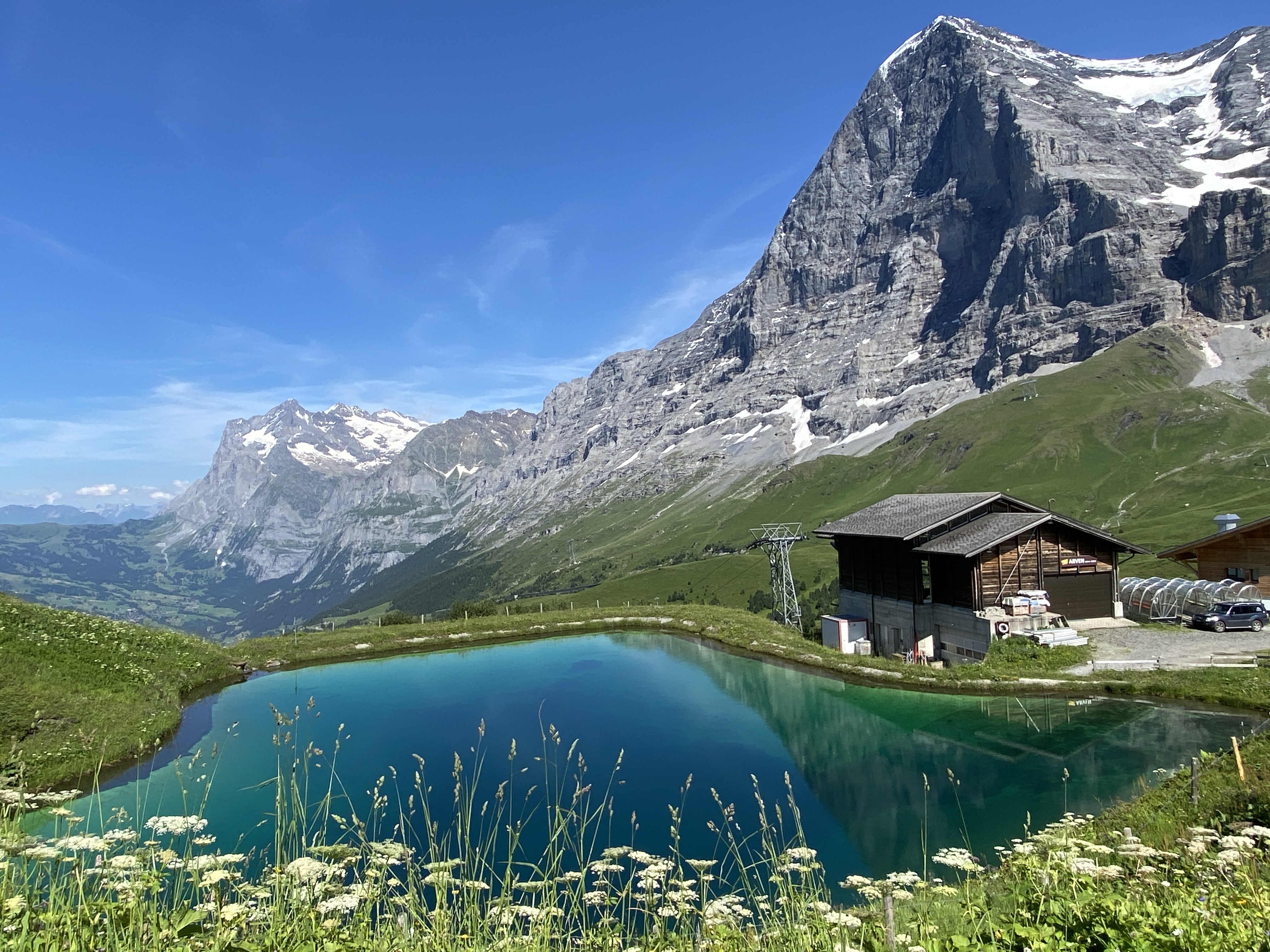
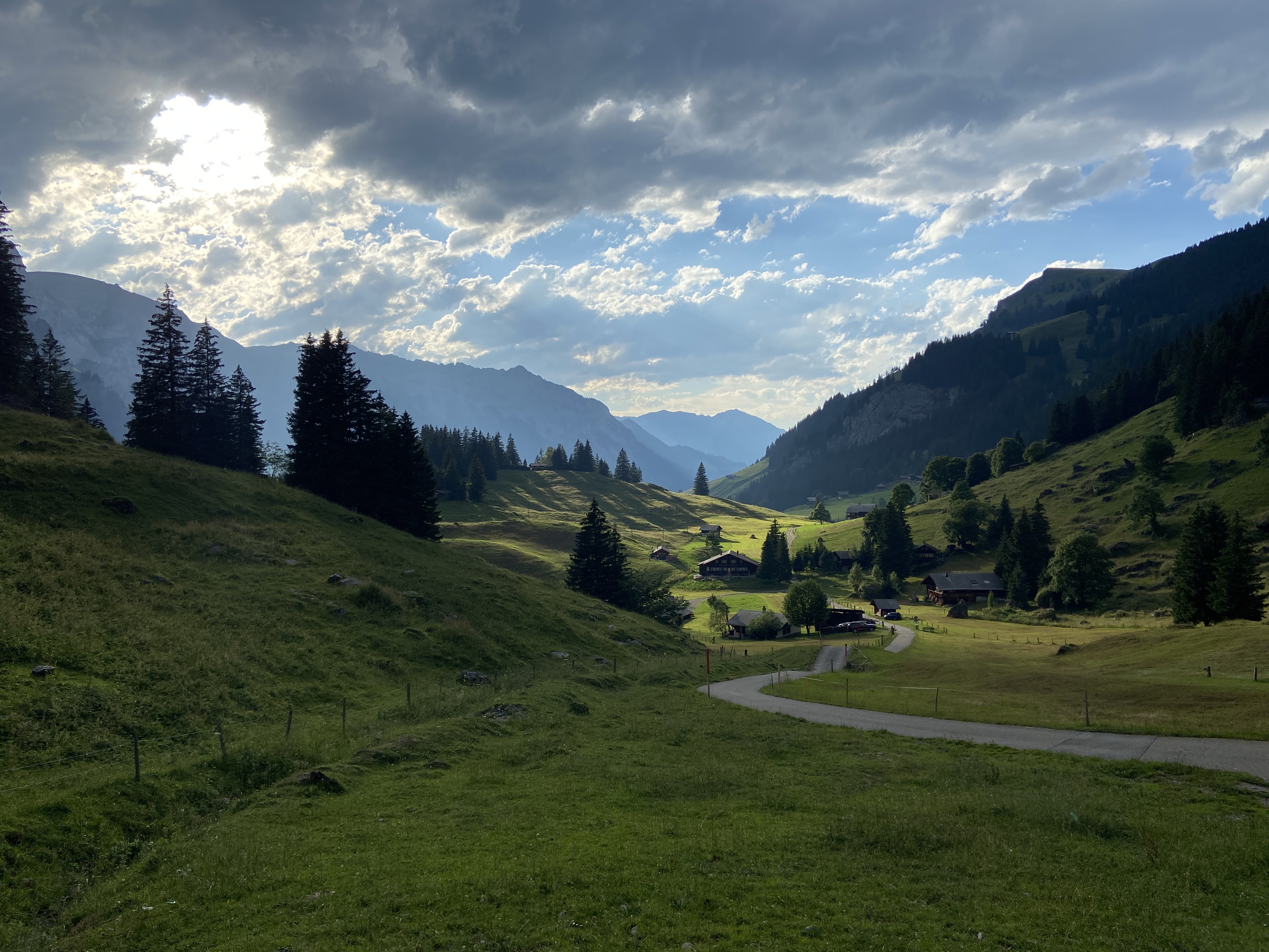
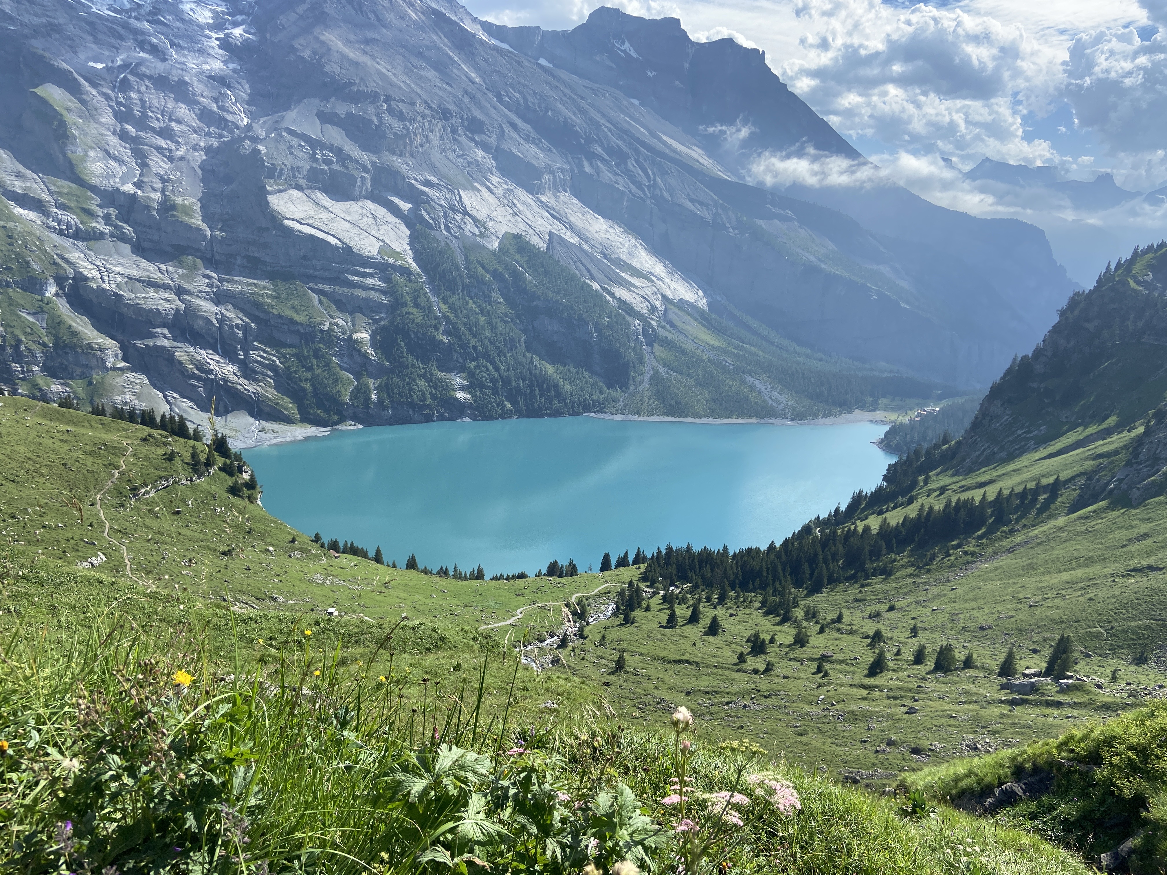
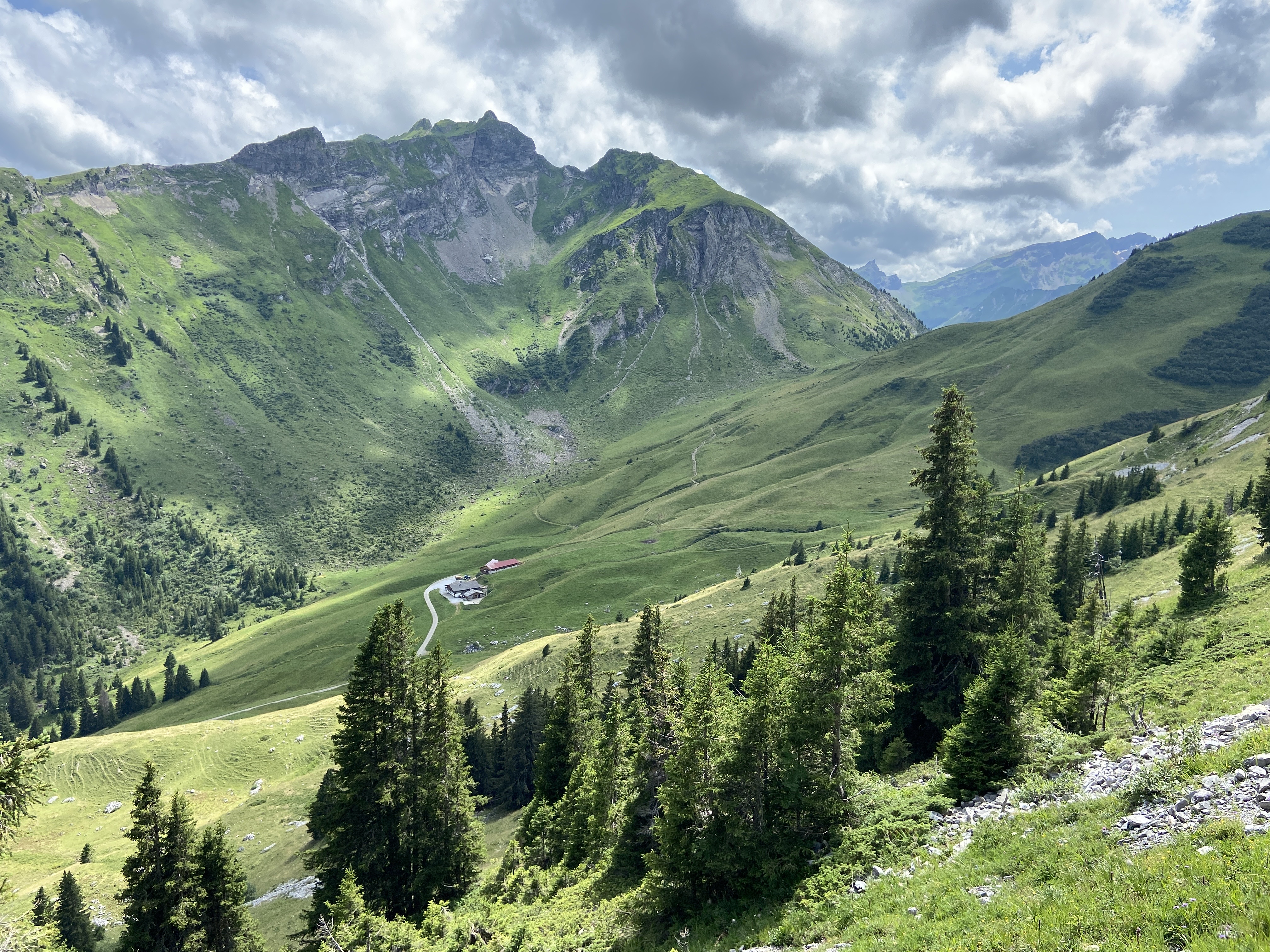
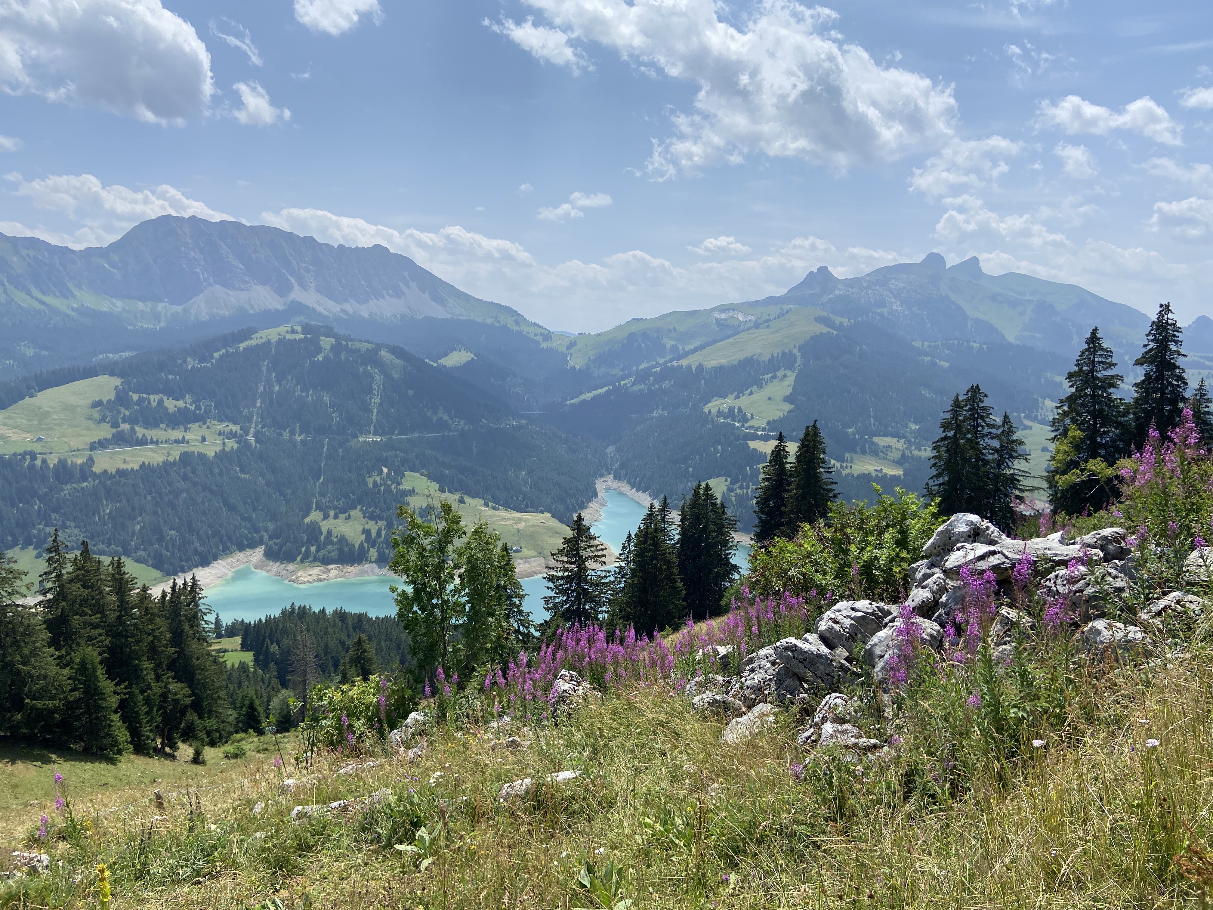
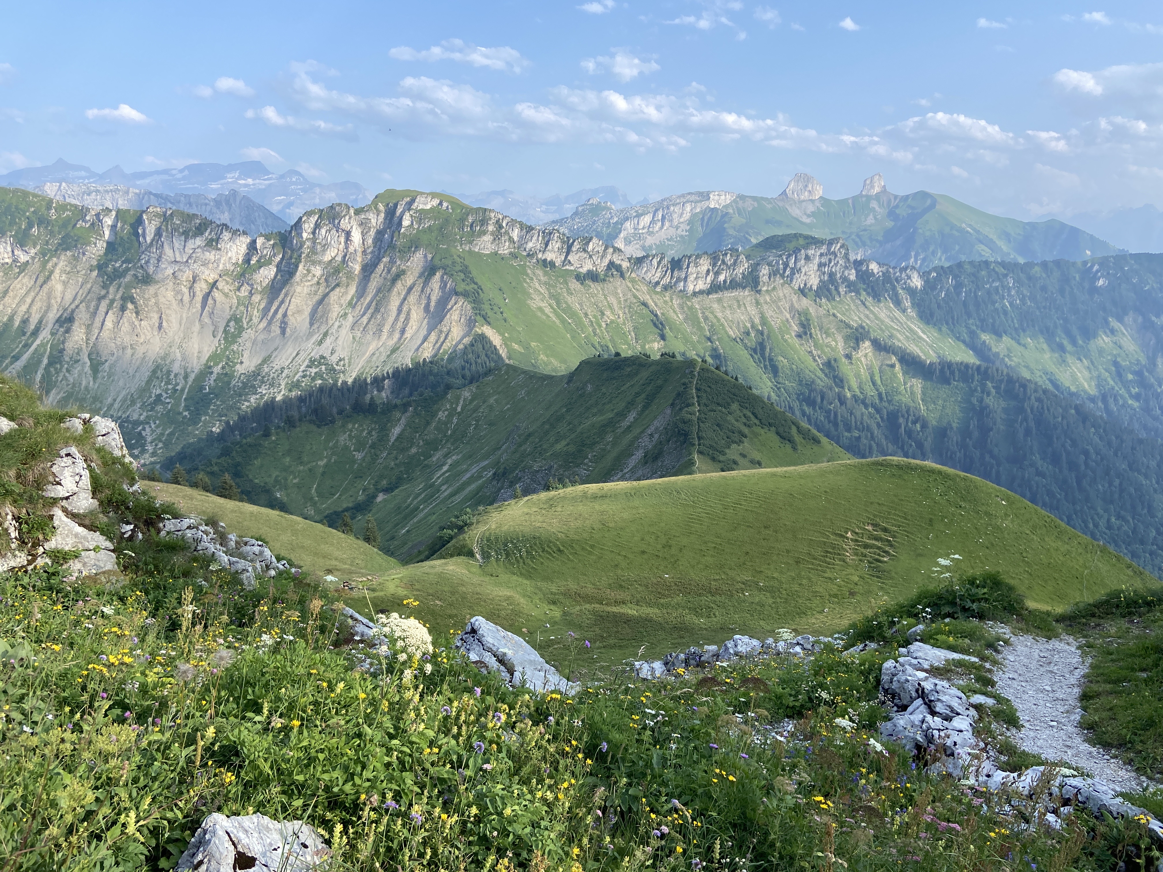
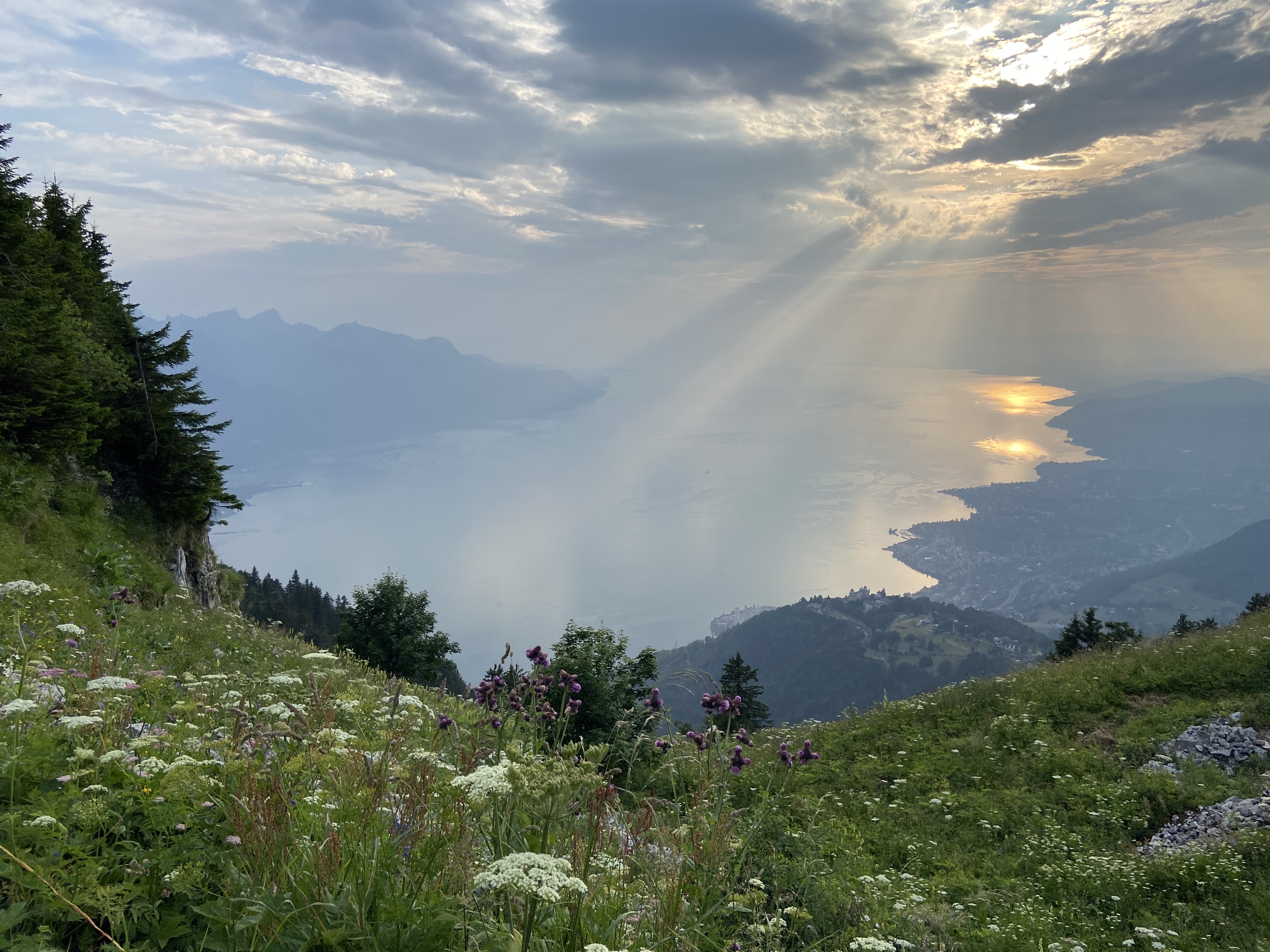
Some beautiful photos from my trip

Planning the trip
I used a large spreadsheet (here’s my template in .numbers or .xlsx) to plan my trip, filling it with hike info, lodging info, etc. I started planning and researching for the trip about half an year in advance, and I finished booking all my accommodations two months in advance. Most of the towns along Via Alpina are popular tourist desinations and have many hotels and frequent train / bus schedules, making the planning relatively easy. Amongst all towns on Via Alpina, Weisstannen, Urnerboden, Engstlenalp, Griesalp, L’Etivaz, and Rochers de Naye are the more remote ones and they require more planning effort (the bus / funicular train schedule is sparse and ends early in the evening, fewer hotels means earlier booking, etc.)
Time of the year
Via Alpina is a summer trail. Most online resources recommend hiking Via Alpina between mid-June to mid-September to avoid excessive snow in high altitude areas. I started on June 29 and finished on July 24 and only encountered small snow patches around Surenenpass and no where else.
My strategy: booking lodgings for 2-3 nights each, and take public transit to travel from start / end points of the hike and my lodging
My favorite weather for hiking is partially cloudy partially sunny. Unlike some tough hikers, I don’t like hiking in heavy rain because wet shoes can take ages to dry and the rain / clouds occludes the scenary. (I was even more rain-avoidant because my veteran hiking boots have holes on them…) The summer weather in Switzerland varies by the day, so I make my plan particularly flexible and choose my rest days based on the very accurate MeteoSwiss (or their app) weather forecast. I achieved it by staying for 2-3 days at each hotel / Airbnb, and use public transit to move between the start / end point of the hike and my lodging. If I had booked lodgings at each exact town along the route, I would have been restricted to hike each section following a schedule determined by my lodging location, without the ability to respond to weather forecast. Furthermore, I get to hike with lighter backpacks once in every couple days, because I can leave some weight (e.g. laundry and some food) at the lodging! Here is the list of cities / villages in which I stayed during my trip. Most of them are within 1.5 hours by public transit from the area I was hiking during my stay. (The locations in the parentheses are the area that I planned to hike when I made reservations for the Airbnbs / hotels. I mostly followed the plan but also made adjustments based on weather and my own condition.)
- Buchs (2 nights, near Vaduz)
- Sargans (2 nights, near Sargans and Weisstannen)
- Braunwild (4 nights, near Elm, Linthal, and Urnerboden)
- Luzern (4 nights, near Altdorf and Engelberg)
- Engstlenalp (1 night, for the night after hiking from Engelberg to Engstlenalp)
- Grindelwald (2 nights, near Meiringen and Grindelwald)
- Wengen (2 nights, near Kleine Scheidegg and Lauterbrunnen)
- Griesalp (2 nights, for the night after hiking from Lauterbrunnen and a rest day)
- Spiez (3 nights, near Kandersteg, Adelboden, and Lenk)
- Gstaad (2 nights, for a rest day and the night after hiking from Lenk to Gstaad)
- Chateau d’Oex (3 nights, near L’Etivaz, Rossinière, and Rochers de Naye)
- Montreux (2 nights, for a rest day and the night after hiking from rochers de Naye to Montreux)
The cost of the lodgings ranges from USD 69 to USD 160 per night. I suppose one can further reduce the cost by staying at shared rooms and dormitary style youth hostels, but that was not an option for me due to health issues. In general, cheaper options (youth hostels and cheap hotels) in towns on the Via Alpina route get booked out 2-3 months before the travel dates, but one can always get a more expensive one or book lodgings farther away from the trail (excluding the 6 remote towns Weisstannen, Urnerboden, Engstlenalp, Griesalp, L’Etivaz, and Rochers de Naye). One advantage of staying at Airbnbs is the ease of doing laundry, as laundry service at hotels is not something I can / want to afford (often costs 5-10 franc per piece of garment, and takes more than 24h). Airbnbs are not really an option in the Grindelwald-Lauterbrunnen-Griesalp area, but I managed to find a public laundry in Wengen.
I highly recommend using the extremely convenient and reliable SBB Mobile app to look up public transit schedules (frequency and duration of the trip) before booking lodgings that require transit. I bought a half-fare card for all Swiss public transport upon arrival at Zürich airport, which was a good deal as I was taking lots of public transit during my trip. Note: I did encounter a mishap where SBB canceled the trains that I was planning to take. To SBB’s credit, they only canceled the trains from 21h-00h due to engineering work. I was saved by a friend who lives nearby and let me crash in short notice for a night. Thank you, Theo.
Collecting stamps
One can order a passbook online and collect stamps along the hiking path. The exact locations are indicated on the same website under the second section. Note: The stamps for each mountain pass are actually located at the towns immediately follow, e.g. the stamp for Foopass is in Elm.
Training for the hikes
I did my best to hike as much as possible during the 2-3 months leading up to my trip. In particular, I hiked every weekend with 8-13 miles and 2k-4k ft elevation gain each time. My training was insufficient and I needed more. If I could re-do it, I would add (a) hiking for 2-3 consecutive days and (b) getting used to trekking poles to my training schedule.
Food
Restaurants in Switzerland are expensive. I buy food from grocery stores to keep my budget reasonable. Note that grocery stores (Migros, Coop, Aldi, etc) can close as early as 18h, especially in remote villages. Convenience stores (Migrolino, Coop Pronto, Avec, etc) near train stations are slightly more expensive and have less options but may have longer hours.
Water
There are many water fountains along hiking trails in Switzerland. In addition, one can often find little creeks on the trail for filtering water. I usually took 2L of water with me and I refilled whenever I encountered water source. (Note: I did take public transit to skip some steep sections and cannot report conditions of those sections.)
Navigation
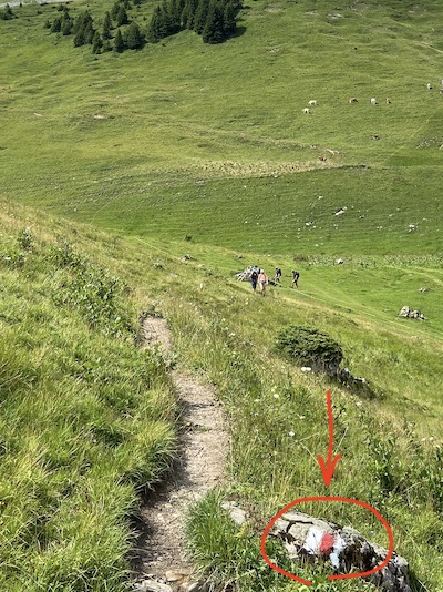
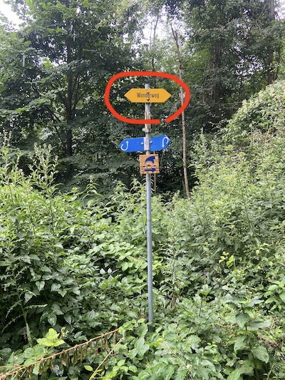
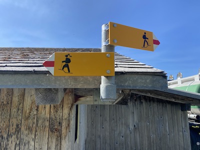
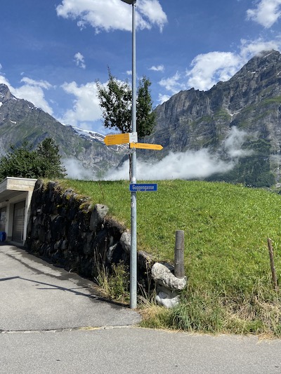
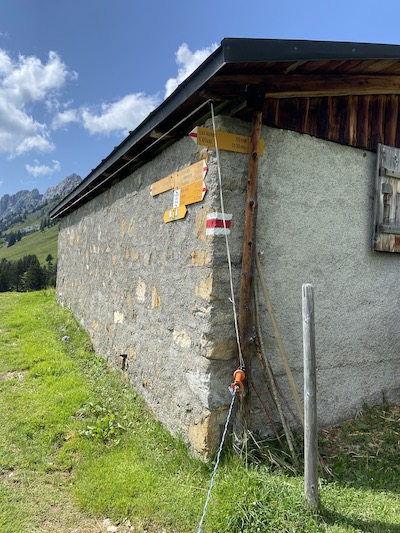
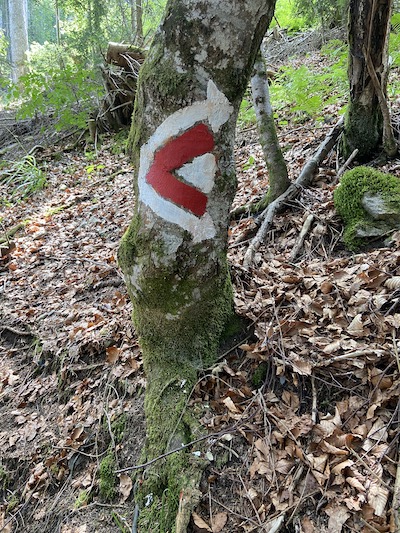
I highly recommend Switzerland Mobility app which is the official network for non-motorized traffic in Switzerland. Along the way you will also find clear signposts indicating the direction of “wanderweg” (walking trail) or “bergwanderweg / chemin de randonnée” (hiking trail), as well as white-red-white paint on rocks or trees or fences, or a yellow diamond-shaped marker. Here are some examples:
When hiking in Switzerland, you’ll frequently encounter cows and fences to enclose them to the farm. Remember to keep the gates closed after you pass it, and don’t get close to mother cows when young calves are around!
Backpack content
See my Lighterpack list for the complete content of my backpack and the weight of each item. I intentionally chose to bring only 3 sets of clothing including the set I was wearing. I spent a lot of time doing laundry during this trip, but I got to pack light (28L backpack). I bought the trekking poles after having my quadriceps destroyed by the 1450m (4756ft) elevation loss from Weisstannen - Elm, and wish that I had bought them at the beginning.
My thoughts
Things that I wish I had done differently
Other than training more thoroughly (with consecutive day-hikes and trekking poles), I really wish I had saved myself a couple more rest days near the beginning. I had to forfeit two segments due to illness and soreness during the first week. On the other hand, I was feeling really good and didn’t need to take some rest days that I had scheduled near the end of my trip. Another thing I wish I had done was to wash my backpack on my rest days when I had at least 24h to hang dry it. It was smelling really really foul at the end of the trip, from the insurmountable amount of sweat that it has soaked up.
To tough it out or to take public transit short-cuts?
During the first week of this trip, I was faced with the challenges coming from my own insufficient training and the over-exhaustion from hiking on consecutive days. My hip where the backpack’s waist belt sits are mildly bruised. I got a blister on my toes for the very first time of my life (thankfully it was the only blister of this trip). I was sore my entire body and a night of sleep was simply not enough for recovery. I had to start taking public transit to skip through some parts because it didn’t feel like I could make it without reenacting the severe illness that put me on full-time medical leave for half of 2022. I was very disappointed and felt like a failure. But I kept moving and hiked whenever I felt capable. Eventually I became strong enough and finished almost 2 sections on the last day: I hiked from Rossinièr to Rochers de Naye to Glion on the same day, covering 19.19 miles, 6000 feet elevation gain, and 6700 feet elevation loss. Although I can’t say “I finished Via Alpina Green!” at the end, I still got my rewards – seeing the magnificent mountains and feeling in paradise. For me, it was a powerful lesson that the achievement can appear so pale when compared to the beautiful scenery one sees during the process. I may not get the certificate for finishing Via Alpina Green, but I will always remember shedding joyful tears at Rochers de Naye from the pure happiness of looking at the mountains. Compared to the official total length 241 miles with 77800 feet elevation gain, I hiked 196 miles with 56000 feet elevation gain.